


Anglesey's Wild North Coast - West of Cemlyn Bay
Updated: Jul 11
Walk: A circular walk along the coast from the National Trust car park (free) above the rock arch at Ynys y Fydlyn to Trwyn Cemlyn, the head of the headland at the north end of Cemlyn Bay and then back inland on quiet tracks and lanes.
Distance: about 7.5 miles
Bus: not required on this one (there aren't any anyway that get near to the coast on this corner of Anglesey)
Parking: Small public car park - free. Managed by The National Trust - space for a dozen or so cars
This walk takes in the west end of Anglesey's wild north coast. It’s not as wild as the east but is remote enough to get a bit of tranquillity. I did it this time with MMM (my Mate Martin) and Rosie. It was in the hot spell in June 2026 - so was ideal for an early start. We started walking at 7:15 (after having to go back up the road 1/4 ml to find a parking place in a pull-in as the national trust car-park was being re-surfaced - comic timing) and got back to a very hot car at about 12:30.
The car park serves to give motorists access to the small rocky beach with a tidal island that has an arch under it (Ynys y Fydlyn) which is about 15 minutes walk down the hill. You'll find the car park on an OS map, on the lanes less than 2 miles north of Rhydwyn.
Warning though, access to the headland north of here is permissive - the landowner breeds pheasants and the seaward route around to Carmel Head is shut from 14th September to 1st February (shooting season I guess) - so plan to do this outside that time as the first climb up from Ynys y Fydlyn is one of the best bits.

From the car park make your way down the track. There is a big dairy herd around here and the tracks get them back for milking. Being a dairy herd though, they are used to humans and the few we saw were OK with Rosie (cows not humans). When the cows are ‘coming home’ it can get a tad congested. There is a post-marked path alongside the track to maintain your headway. Take the options that take you straightest down to the rocky beach and island without getting drawn off too far left (south) as you may end up on the path to Church Bay (Porth Swtan) rather than Cemlyn Bay.
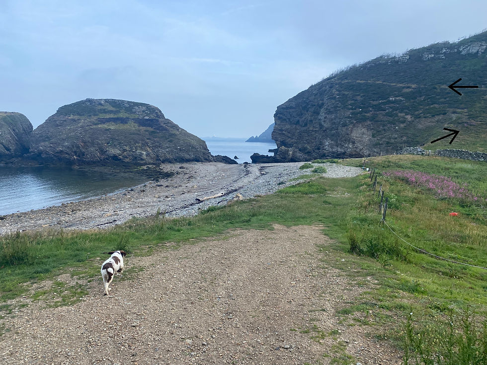
Once at the rocky beach, our route heads off uphill at the right hand side of the beach (through a gate) toward the rather dead looking conifer forest before angling back to contour (vertiginously) the seaward edge of the headland. The die-back of this forest isn’t due to any sort of disease (apparently), just the effect of the frequent strong salt-laden winds on this exposed edge of North Wales.

If you aren’t keen on heights, it’s only a short distance before the path turns inland again.
Before it does be sure to look over your shoulder to see the large arch and Mediterranean looking sea under and around Ynys Fydlyn.
The walk now is just pleasant with the sea and the skerries lighthouse always visible to the left.

The lush grassy landscape is split into sections, presumably to manage the dairy herd feeding. Between each is a single wire fence (presumably electrified when the cows are around), with angled wooden cut-throughs to let humans and their dogs through. Minimal and effective.
At some point you will see the White Ladies (two large angled white braced structures facing out to sea). There is what looks like a lime kiln (a chimney) before them - though I think this may be a relic from a small copper mine associated with the ruined building to the seaward side of that structure.

The White Ladies are maritime navigational aids from the days before ships had engines and GPS. It’s no accident that they line up with a small tower on the nearby offshore island of West Mouse (Maen y Bugael) as a line between all 3 points to a dangerous reef just beyond West Mouse. To be honest the whole of this bit of coastal water is dangerous. They must have been nutters to come anywhere near, particularly in the age of sail. You can hear the water rushing between and over the submerged reefs as you walk along. It’s more like walking alongside a white-water section of a river than the coast. Respect to them though. It wasn’t a hobby done for fun - just a dangerous way to make a living.

Just about at the chimney, the path splits in two. It is the most seaward of the split that we want, pointing toward the lower of the White Ladies. As you approach the White Lady, there is a there-and-back option to head out to the end of the rocky promontory of Carmel Head. We didn't do it, but I will next time. I reckon it would be a good place for a bit of wildlife spotting. Just after these prominent landmarks though, there is a little rock, weatherworn and rounded and just the right height to sit on. Well worth a stop to feed your body and soul whilst looking out to the small island (West Mouse) with the third 'Lady' on it. Plenty will have sat here before you with very much the same sight in front.

Ten minutes further on there is access to a small cove alongside a bridge that crosses the stream that finds its way back to the sea here. A perfect spot for Rosie to do a bit of 'furry dipping' before heading east again. The outline of the Wylfa Decommissioned Power Plant is more visible now, though still 3 miles away . We don't go that far though as, before it, is the Nature Reserve of Cemlyn Bay - a pristine bit of coastline behind which is a large lagoon. The area is absolutely awash with sea and fresh water birds at this time of year. The end of the promontory that forms the northern section of the seawater bay marks the point where we will turn back and head back inland on the shorter route back to the car.

The next section of the walk is across a flat section of grassland bordering the jagged rocky coast. As you approach the shingly bay at Hen Borth (a bit like Ynys Y Fydlyn, you can't really call it a beach) the amount of wildlife starts to increase. It was getting hot by this point and a small troop of cows were making their way to the beach, to which they had access, presumably to catch the breeze and find some shade under the sea-eroded clay banks that line the eastern part of the bay. Like the earlier cows, apart from some staring, they didn't bother us at all. Climb gently out of the bay above the clay banks, and the aerobatic Sand Martins that live there, toward a chapel and some farm buildings behind it. Just before you start uphill, there is the option to divert off the coast path and go and have a look at the chapel - St Rhwydrys’ Church. We didn't, something again for next time. It's a proper old thing and looks strange sat in the middle of nowhere with the farm buildings of Tyn Llan just behind.

I'm guessing that plenty of people make this diversion as the next section of the coast path was becoming overgrown, passable but less tramped than the sections we had done so far. The bonus for us though was the noise. On the one side, the mournful calling of a group of Atlantic Grey Seals on the rocks just 100m off the coast. On the other side the chaotic calls of what must have been 1000 or more terns, all talking over one another (like an episode of Seabird Eastenders), near the causeway and the lagoon 500m or so to our east.
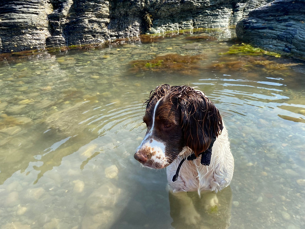
Continue along the path hugging the coast, until you run out of land. You are now at Trwyn Cemlyn (Cemlyn Headland). It was about 10:30 at this point but we were the only people there. It's a lovely spot, there was some shade under some rocks and plenty of rocky pools with wonderfully clear but ice cold seawater. Clear until Rosie kicked the silt up that is.
A good place to cool off. After some food and a dip, it was time to head back to the car before it got too hot for Rosie.

The way back is straightforward enough, we headed down to the lagoon with its birdwatching human demographic and the impressive walled house that used to belong to Captain Vivian Hewitt, the guy who was first to cross by aeroplane between mainland Britain (Rhyl) and Ireland (Dublin). Almost 75 miles. An epic fete in 1912. Largely forgotten as two weeks earlier, the Titanic had hit an iceberg and hogged the headlines. Captain Hewitt was a very keen ornithologist and a bit of a recluse, he killed two birds with one stone (sic) by building the impressive wall that acted both as a windbreak for his bird-friendly garden and as a barrier to avoid being oggled at.

After the lagoon, at the end of the lane feeding the house and Cemlyn Bay Nature Reserve Car Park, turn right on a quiet lane (part of the 'round Anglesey cycle route), past a pretty white cottage and continue up the lane. Pass the marked paths coming in from the right and continue 50m or so, until, just as the lane turns sharp left, go straight on using the footpath to the right hand side of the cottage in front of you (a tad overgrown but passable) and, eventually, onto a lane/track toward the large farm of Mynachdy.

The track has the, now familar, single wire fencing to keep the cattle on the straight and narrow (literally). Continue up the track toward the farm. Once approaching the farm, don't get drawn off left in front of the open end of the large wooden slatted barn. Rather go up into the collection of stone buildings and turn left (well signposted once there) up a track behind the closed end of the wooden barn. This track leads gradually upwards, passing another farm building to your left (which looked for all the world like it had a pet cow keeping the lawn short) and eventually joining the lane on which the car is parked. Keep right at the junction, continuing uphill for about half a mile before arriving back at the car park (presuming it wasn't being resurfaced again). I'll be back to visit the Carmel Head headland and St Rhwydrys’ Church - perhaps when it's not so hot.


Comments