Basingwerk Abbey to Flint Castle on Wales Coast Path (with a bus one way)
- daveatkinnerton
- May 4
- 7 min read
Updated: May 31
Walk: An unexpectedly superb level walk between Basingwerk Abbey (in Greenfield near Holywell) to Flint Castle along the River Dee Estuary
Distance: 7 miles
Parking: Free Parking at Flint Castle
Bus: F19 from Flint to Prestatyn/Rhyl - Getting on by McDonald's in Flint and getting off right by the Abbey in Greenfield (the stop after the bus has turned off the coast road up toward Holywell)
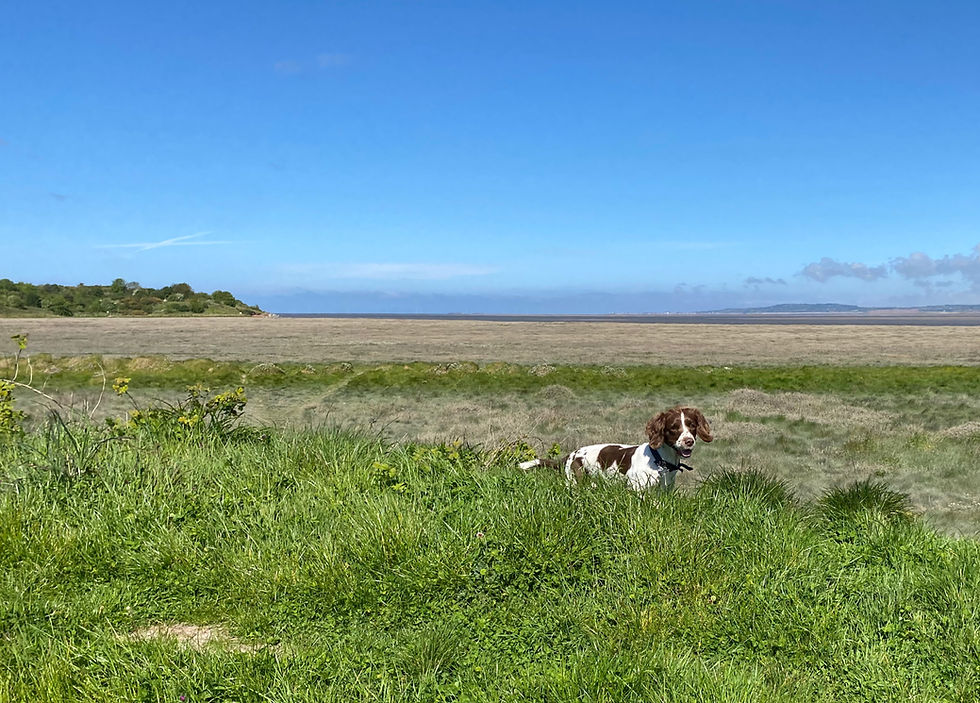
Our next door neighbour, Jane, mentioned that this piece of Coast Path was great for a walk with a dog. The Minister for Holidays then explored it with some regular walking friends (without dogs) using the BusPassNBoots ethos of making a longer linear walk out of a scenic stretch of coast or countryside by using public transport in one direction. She was also very impressed, so much so that she persuaded me and Rosie to do it with her, in chilly but incredibly bright weather, just over a week later (April 2026).
This area of North East Wales is relatively industrial and populated. It's near where we live. My natural preference is generally to go further west to find my 'Paths Less Trodden'. Well, it turns this highly-accessible walk is an absolute gem. Though you will meet some people walking their dogs and even some out for a lunchtime stroll from their place of work, it is a million miles away from crowded. One day no-doubt, some strange-lipped influencer will make it an internet sensation but until then it is an unexpectedly stunning piece of landscape to explore in a peace and tranquillity that belies its location.
As is the way with these things, its best to park near the end of the walk and catch the bus to the beginning. You know where you are then and the buses aren't so regular. So that's what we did. We parked at the Rhodfa'r Castell (Castle Walk) car park (free) just to the north west of the castle. This is accessed off the main A548 coast road (Holywell Road at this point in Flint) via Evans Street, heading towards the estuary, then turning left just before the road becomes Castle Dyke Road to find the small car park 100m on, in the woods on the right. If this is full, there is other free parking by the RNLI station to the south east of the castle.
From the Rhodfa’r Castell car park, retrace your driven route back up Evans Street and cross the main road to the bus shelter just in front of McDonald's on the main coast road. The number 19 bus (Flint to Prestatyn/Rhyl) at 09:46 was perfect for this trip, its about a 10 minutes walk from the car park by the castle to the bus stop and then, when you get on, another 10 minutes or so bus ride to where you get off to start the walk. According to the Minister for Holidays, it is best to get there a bit early as the bus arrived and left at 09:40 when she did it with her friends. The bus stop you get off at is on Greenfield Road - opposite some flats. Ding the bell as the bus levels off having climbed steeply up left off the the main coast road at the traffic lights (signposted Holywell) before the Packet House Pub in Greenfield.

The bus stop is just after the height restricted car park serving visitors to the Greenfield Valley Heritage Park and the ruins of Basingwerk Abbey.
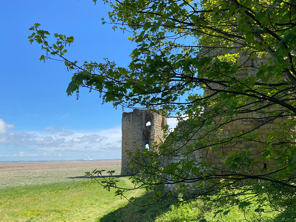
Once getting off the bus, turn left, back to the car park and through it to enter the Greenfield Valley Heritage Park. Aim toward Basingwerk Abbey Visitor Centre (passing a small lake on your right). There are unadvertised toilets in the visitor's centre. It's pleasant enough (and free) to have a look around the ruins of the Abbey but this is by no means the highlight of the walk.

That fat king bloke who had all the wives has some questions to answer when it comes to wrecking historic buildings doesn't he? It seems to me that there's a very similar just slightly more orange bloke in the news a lot just now, creating just as much, if not more, havoc.
If you do have a mooch (we did), to continue the walk, you must exit the ruins through the same gate you use to gain entrance. Once back out, turn left to follow the path around the outside of the fenced ruins and down to the larger car park alongside the main coast road.

Cross the road and head up the lane opposite (with a well kept cenotaph on the corner) heading to a road bridge over the railway. Pass the scrapyard and sewage treatment plant (don't worry, it does get better!) to arrive at a small harbour (told you it would get better!)
Go to the other side of the harbour, beyond the red and white ornamental buoy to pick up the rest of the walk heading south east right alongside the Dee Estuary. The first section is tarmacked but is traffic free. The occasional views across the estuary to the Wirral are immense. If you have your binoculars with you keep your eye out for the Atlantic Grey Seals hauled out on the estuary sandbanks. If birds are your thing then there are loads. Some terns were giving us an impromptu display (a turn if you like!) diving for sand eels or whatever it is they eat. The Dee Estuary is a food-rich stopping off point for all sorts of migrating seabirds and waders. At this point it starts to feel like you've gone through the back of the wardrobe in a children's book.

Happily, it's almost impossible to get lost as you just keep following the Wales Coast Path signs on the paths and tracks closest to the estuary. Eventually you reach another inlet on the outskirts of the Bettisfield Colliery Site. Bettisfield was a mining area (coal) until just before WW2. The inlet was used by shallow draft ships to get the coal away. The now-landscaped and re-wilded colliery site is yet another unexpected gem. When you arrive at the inlet, turn right and follow the track around its head. Just past the inlet take the shortcut footpath uphill and through a gate onto the Colliery Site proper.

The area now forms an elevated promontory (the old colliery waste heap) with arguably the best all round views on the walk. It is managed to support a re-introduced population of Natterjack Toads that can be heard shouting about how attractive they are on spring evenings. No such thing as a shy Natterjack.
There's a complicated working sundial just where you enter, lots of fun if you haven't looked at your watch recently. Head on up the hill passing the sundial on your left, towards the sculptures and beacon at the promontory end. Before you do, just have a look backwards (inland) to where the bleak historic mine buildings meet the rather more attractive farmland and landscaped managed parkland. You can have a look around some of the old buildings apparently but industrial architecture just isn't Rosie's 'thing' so we kept to the estuary
Go past the Beacon at the end of the promontory and carry on around through some gorse and gates and a 'folly' stone circle to join a track again heading along the estuary and salt marsh towards Bagillt and another major inlet. At the head of this one, I was excited to see a large outlet that, at first, I thought must be to release water to scour the deposited silt and keep the narrow channel open. I later read though that the water it lets out comes from the hills of Halkyn, miles away, through a man-made tunnel constructed to drain the liable-to-flooding lead and zinc mines up there. An epic endeavour.

Follow Wales Coast Path signs along the saltmarsh and sea defences (Panton Cop). The tide was pouring out of the estuary at this point. It leaves you marvelling at the seamanship involved in getting to Flint and Connah's Quay and, even in Roman times, as far as Chester.
Digression alert: More recently barges were used to transport the large wings for the Airbus A800 along here (from the factory near Saltney Ferry (upstream) to Mostyn Docks (downstream)). I regularly used to see them on my cycle ride to and from work back in the day. A modern day epic endeavour. The A800 isn't made anymore and they are able to fly the wings for the smaller craft now in production out on modified transport jets. Actually the jets are quite cool, they are called Belugas and the clever designers have even painted eyes and a mouth on the latest of them - I still stop and gawp, wondering how something that actually looks like a Beluga whale actually gets and stays airborne. End of digression.

At the end of the cop, in amongst the Sand Martins that call the gravel banks home, you are directed up into the pretty birch woods. Lovely. There is a high-tide route marked here. It cuts directly across this promontory rather than going around. It should really be called Exceptionally High Tide Route - I guess that would've cost more.
We continued around the outside, as close to estuary as the tracks allowed without going onto the estuary - the estuary itself is perfectly valid route for those not in the company of a swamp-obsessed spaniel and who don’t still have to drive home with said hound. Following the Wales Coast Path signs leads you to the final inlet of the day, Flint Harbour. As with the other inlets, the path leads around the head but in this instance heads back out toward the estuary, hugging the other side of the inlet in the same sunlight-dappled birch woods.
Around the next corner, you get your first view of Flint Castle - the end of the walk. It seems sort of romantic now, rather than oppressive. Not a king to be messed with was Longshanks - probably even more ruthless than the fat one with lots of wives but not quite as spoilt. Building rather than destroying (although that depends on whos gang you were in, I guess)
Another 5 minutes or so and you are there at the Castle. It's well worth a look around, particularly the very scary open steel staircase giving access to the fine views from the highest tower. There is definitely a voice that starts half way up (the voice in control of your anal sphincter I reckon) questioning whether it's the cleverest thing you are doing to continue. I'm OK with heights and I definitely had a moment. A memorably shaky-legged way to end the day.


Cracking tip for extending our little bimble. Will do this soon
Loved this walk when I went with the Minister. Fabulous photos Dave.
Brilliant walk ❤️❤️