Straightforward Criccieth to Porthmadog
- daveatkinnerton
- Jun 28, 2024
- 8 min read
Updated: Sep 30, 2025
Walk: Criccieth to Porthmadog along the Wales Coast Path
Distance: approx 7.5 miles
Parking: Road-side parking alongside sea wall in Borth-y-Gest
Bus Service: No 3 Bus service (Porthmadog to Pwllheli) run (in 2024) by Caelloi
An absolutely straightforward walk along the coast path between these two holiday destinations. For free parking (and public loos) I headed to Borth-y-Gest - just about a mile from Porthmadog along the coast toward Morfa Bychan/ Black Rock Sands. There is on-road parking here at various places.

Having parked up, and both having emptied our tanks (one of us in the public loos on the pay and display carpark, the other on the grass by the sea wall), Rosie (Spaniel/ Swamphound) and I headed off to Porthmadog to catch the No 3 bus. Getting from Borth-y-Gest to Porthmadog is a simple task of following the Wales Coast Path signs back up the estuary (North). After going up through the houses at the far end of the beach on this photo, the Wales Coast Path approaches Porthmadog alongside the harbour area. It's less than a mile's walk. Not particularly pretty as it uses the largely-traffic-free access road to the marine business zone. There are all sorts of businesses catering for all manner of marine crafts and activities.
The land on the other side of the stretch of water, viewed between the chain-link fences of the aforementioned businesses, is an artificial island. It was created by the unloading of rocks used as ballast on the inward trips of cargo vessels when Porthmadog was a thriving port. The ballast rocks were thrown overboard to make room for other, more valuable, rocks (mostly slate I guess) for the outbound trips. Business must have been buoyant (groan!) as the ballast rocks eventually piled up above the high tide level and 'Ballast Island' was born.

The walk into Porthmadog takes about 20 minutes. Once in Porthmadog, the bus stops are on the main road opposite The Australia Pub/Brewery. The number 3 bus says it goes from stand A (in the timetable and on the digital board) but actually leaves from stand B. No problem as they are alongside each other.
I quite like Porthmadog. I feel a link to it, particularly since I found out I was baptised here. No time to hang around today though. We have a BussPassNBoots walk to do! The bus is signed for Pwllheli but goes through Criccieth on the way. We caught the 8:50 am service. The next one after that would have been 9:30 and after that 10:30. Any of these would have been fine. Having caught the early one, we were actually back at the car at around 13:00 on this trip.
It's obvious when you are approaching Criccieth as the castle provides an unignorable landmark. You can get off anywhere along straight run in but having 'prematurely ebusulated' on a previous trip in 2023, and faced a half-mile extra walk to where I thought we would stop when I pressed the button, I held back and got off at the intended stop (near the shops and level crossing) this time. There is a rather nice bakery in the row of shops opposite the bus stop. The last time I did this walk (July 2023), the 'Minister for Holidays' was with us. She is an expert in 'all things pie' and gave the meat and potato offering from Idris Bakery a very high rating (4.5 if I recall). I concurred.

Too early for pies this time, so we headed down, across the level crossing to the sea to start our walk back east. A dog ban is in force from April to October on the beach beneath the castle, so we stayed on the promenade and eventually, as the promenade road turns back inland, followed the steps down to the long shingle beach which takes you toward the distant drive-on beach at Black Rock Sands and eventually back to Borth-y-Gest.

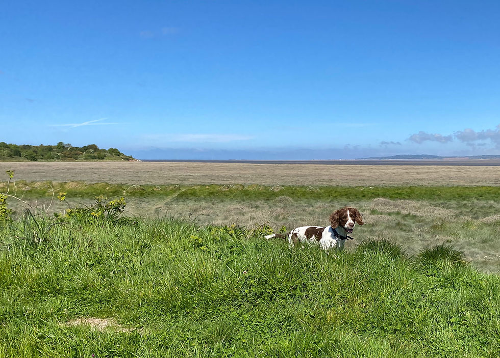
Time for a swim (for Swampy, not me) and some photos back toward the castle, and then make some headway on our walk. I enjoyed this bit a lot. We met some people out with their dogs and some jogging (and even a few jogging with dogs) but, pretty much, had this beautiful beach to ourselves.
The tide was out far enough that we could walk on the sand. We therefore made quick progress toward the promontory of Craig Ddu (or Graig Ddu) that splits this beach and the shingle-less one at Black Rock Sands. The main path (perhaps anticipating high tides and uncomfortable slogs across shingle) follows alongside the railway line about 100m further inland. Stuff that!
One consequence of following the beach though, is that when you get to Craig Ddu, it isn't at all clear (signage wise) where the continuing route goes.

I have a feeling that the signed path circumnavigates the hill on the inland side. You could do this by following the track that veers off this way, over the bank of shingle, before you reach the end of the beach. Every time I have done this walk, however, I have chosen to go over Craig Ddu, for the views if nothing else, and I saw no reason to do differently this time.
There is a path, indistinct until you are on it, that zig-zags up the grassy slope on this photo to find a ramp up through the rocks near the top. Once up top, you have views across the expanse of sands that presumably takes its name from the promontory you are on (Craig Ddu (Graig Ddu) translates to Black Rock). You can also see across to Harlech and the southern snowdonian coast.

At the top of the promontory, the path, still indistinct, heads inland heading toward the recognisable shape of the distant hill (Moel-y-Gest) until it meets a wall and, eventually, a relatively new collection of luxury cabins that overlook Black Rock Sands up to the estuary and, further down the coast, Harlech and Shell Island (Mochras). Lodges I expect they are called rather than luxury cabins.

It's a bit annoying now (but a whole lot safer than 40 years ago) as you can no longer get down the steep hillside (with cliffs at the bottom) directly onto Black Rock Sands beach. Rather, having gone through a gate by a cattle grid toward the entrance of the holiday park (Parc Taliesin), you are diverted inland (left in this photograph), once again heading toward Moel-y-Gest, downhill on the track used to access the lodges. Eventually this track reaches a tarmac lane. At this point Wales Coast Path signs direct you right, heading back toward the sea along the lane and alongside the camping site that you will have seen below you as you descended the track earlier.
Because Swampy isn't allowed to put her fair paws on this part of the beach, on which cars, with their dripping oil and attendant rug-rats and litter are permitted (after they pay the reasonably large parking fee of course), we can't go directly onto the beach but have to follow the lane around, parallel to the sea, to the main (vehicular) access point.

Not too much of a drama to be honest as to the left (east) of the main access point, dogs are allowed and there are still a good few miles of the same hard sand and clear water that used to attract me here when I was in my late teens and twenties. I can't help humming the Lionel Ritchie songs that still conjure the smell of suntan cream, sea and the exuberance of owning a car with a cassette player, and of hot summers and youth. I know you are only young twice but, on the second time around, it seems more difficult to exube in quite the same way. (What? Exube is not a word? Ridiculous).
Heading east along the beach you eventually reach the signs that say No Vehicles Beyond this Point and start to head around into the Estuary. Though I've never seen them, Ospreys (which have nesting sites on the Glaslyn plains near Point Croesor) occasionally hunt this stretch of water for some tasty fish. I think you are just as likely to see them patrolling the lagoon on the right hand side of the causeway (The Cob) as you enter Porthmadog from the north east though. Unsurprisingly, there were none to be seen today. Worth keeping an eye out though.

This photo shows a view back along the beach after we turned into the estuary. It's a lovely spot of sand on which to enjoy your cheese, lettuce, cucumber, and blown-sand sandwich.
As you are walking along this section, now heading more inland, you will see the first Wales Coast Path sign in a while directing you up a corner in a small rocky outcrop ahead. There must be an inland route too, as the bottom of the path shows signs of having had what was probably an unusually high tide lapping at this very corner.

Once up the rock, the landscape changes to a more typical coast path format with a bit of greenery each side and a clearly defined sandy path with steps and stuff to help you navigate the ups and downs. The path passes some beaches (which were very pretty but a bit smelly to be honest). The path continues heading up the estuary, alongside a golf course on the left, before entering the next set of trees.

Some signs seem to be missing but where there is a choice, taking the path that keeps you moving up the estuary works. Eventually the path through the trees looks like it is going to lead you uphill to some houses, and presumably to a track or road. Just about here though, there is an obvious, yet unsigned, right turn. This takes you off the main coast path on a route that navigates up and down and in and out of several little sandy inlets.

Though lacking the attractive smells of the larger beaches (I think there must have been some sewage management issue), they are undoubtedly scenic. Anyway, the last two times I have done this walk, we ended up taking this prettier route - and we did so again this time.
The last inlet has a helpful wooden bridge across it, which leads you onto the final leg of the walk. The path through the trees gradually leads out into a track with views of the upper estuary and, in the background, the mountains above Ffestiniog toward which the little steam train shuttles paying guests to and back several times a day.

At the end of the track, just around the corner on this photo, is the bay of Borth-y-Gest where the car is parked.
And that's it, you go around the corner to see the toilets, car park and the end of this relatively short, very straightforward and extremely pleasant BusPassNBoots grand day out.


Comments