Eryrys Escarpments via Loggerheads and Maeshafn
- daveatkinnerton
- Apr 17
- 11 min read
Walk: A lovely little walk taking in the limestone escarpments between Maeshafn and Eryrys (near Mold) and using the excellent TrawsCymru T8 service to complete the circle between two very good pubs
Distance: About 4.5 miles
Parking: Free Roadside Parking on road that runs alongside A494 between the Druid Inn and the bus stop at Ty'n Llan - Llanferres
Bus Route: TrawsCymru T8 Service (hourly at time of writing) from Ruthin to Chester
A relatively short walk that by no accident starts and ends near a pub. So it could be described as a P2P route (Pub to Pub). Unusually for nowadays, both these pubs (We Three Loggerheads and The Druid Inn) are open during the day (well, afternoons) - even on weekdays. The walk is delightful in any season as the terrain includes a mixture of quiet tracks, pasture, forests and open escarpments. Being on soft limestone, it drains well. It also takes in Bryn Alyn, the high point on this quieter side of the valley through which the main Mold to Ruthin road (A494) is routed.
There are views west and south to the larger Clwydian peaks and hillforts but you don't even have to look that far to find a lot to please the eye. No slogs through mud or unnavigable paths. At no point does it become a chore, quite the opposite. The AONB (Area of Outstanding Natural Beauty) designation is well represented.

There are a number of stiles on the route so, if you have a dog, a liftable one is a good idea. I didn't have Rosie (the Swamphound Spaniel) with me when I recorded this one - she was on a walk with another dog and the Minister for Holidays. She (Rosie, not the Minister for Holidays) enjoys the cuddle that being lifted entails - so we'll do this one together soon. Luckily, my friend Tony who accompanied me on this walk was pretty much expert at stile negotiation. It was me getting used to my new hip that struggled once or twice when I got the angle of attack wrong.

Although it could be done either way around, we chose to park near St Berres' Church in Llanferres. The road on which you park (free) actually leads into the bottom of the car park of The Druid Inn. From the parking nearest to The Druid, it is a maximum of 3 minutes walk (back toward Mold) to the Llanferres Ty'n Llan bus stop and shelter on the A494.
The buses are every hour (at least they are at the time of writing-up this route) - leaving approximately on the hour (March 2026). You want the bus heading toward Chester - this will be on the same side as the church and inn. The bus journey to Loggerheads is only a few minutes and could be substituted by walking the lower level route on the opposite side of the road (via Pen-y-Bryn) to make it a bus-less circular (or even as a bus-less 'there-and-back' on the prettier (and drier) high level route).
We took the bus. Once off the bus in Loggerheads, there are toilets close-by in the country park and, at the time of writing, a soon-to-be-reopened café. On selective days there is also an early-opening 'breakfast bar' outside the We Three Loggerheads Inn.

Our walk starts by walking up to the Loggerheads Petrol Station to find the bridle path/track (on the other side of the road). Head over the wooden bridge that spans the River Alyn and proceed uphill for a couple of hundred meters until you see a gate and footpath sign (on the left) heading across a field toward the Colomendy Outdoor Education Centre buildings. You will notice that, although the footpath sign points towards the main buildings along the left hand side of the field, people have also gone up diagonally right.

These people have been cutting the corner off the marked right-of-way paths as the next path we want is in the same field just slightly above you. It's up to you. If you elect to stay on the marked path (heading toward the Colomendy buildings), just turn right back on yourself onto the upper, more-trodden path when you meet the next gate at the field boundary (don't go over the stile). Following this upper path, you'll end up just above where you entered the field from the bridleway/track and understand why people who come this way a lot have cut the corner. This is now the Clwydian Way footpath, heading south, on which you'll stay for a little while, leave for little while to get some better views, and re-join for a longer stint at Maeshafn.

Follow the Clwydian Way footpath signs entering the wooded area of Coed-y-Fedw at the top of the field. Go straight-on with a black metal fence on your left separating you from the high ropes course of the outdoor education centre. As the fence binds around left, so does the path. At this point it enters the Aberduna nature reserve with a boot-brush station designed to avoid you unwittingly bringing harmful stuff in on the bottom of your dirty boots. The main Clwydian Way footpath bears slightly right, passing the Aberduna information board. However, to make the most of the view west, there is another option detouring left uphill just after the boot-brush. Abandon the main Clwydian Way for now and take this viewpoint path on the left.

The path leads pleasantly up through mixed woodland and eventually breaks out higher up onto open land with the promised view over the Clwydians to the west. Really lovely bit of terrain. Jam packed with those feel-good pheromone things that lightly wooded areas exude. The only sound was the early-spring birdsong - including a Nuthatch hiding somewhere in a nearby tree according to my bird-song App. Continue along the open land, with the view of Moel Famau and its neighbours to the west. Ignoring the several paths that lead up left you will eventually reach a point where it is more obvious that you are above a small limestone escarpment (which drops away sharply on your right hand side). After a pause to take in the atmosphere, continue on the path back into the woods on the same contour.

The goal is to come into Maeshafn village from the west without having to walk up part of the lane from Llanferres (like the main Clwydian Way does). If you've got it right, after re-entering the woods from the viewpoint and dropping downhill slightly, you'll end up leaving the woods through (on this occasion) the aptly named 'Tony's Gate'.
Tony's Gate is at the 'dead' end of a dead-end track with houses on each side - Maeshafn village centre and the continuation of the walk is at the other end.

Once at the village centre, cross the main road/lane by the telephone box and village noticeboard and proceed along a small driveway/track opposite that leads past the Miner's Arms pub. Pass the pub, if it isn't open. Stop for some refreshments if it is!
The pub's name is a nod to the industrial past of this area. Most of the walk (in fact most of this area) sits on top of rich veins of lead which were extensively exploited but now have been largely rewilded and become beautiful again.

The village notice board informs that the Miner's Arms, at the end of a short terrace of stone buildings, started life as the pay office for the local mining company.
The route (now the Clwydian Way again) continues up this track away from the pub and village until a stile at the end (actually at the end of a grass path leading from the driveway to the last house on your left hand side, and alongside a locked gate) gives access to a field. The path goes straight-on following the field's right hand side.

Follow this to the end of the field avoiding the grassy track left up into the trees. At the end of the field, the Clwydian Way path does cut left uphill to a stile followed by another stile (on the right) that gives access to another pasture at the end of which is a windowless house (see photo). Cross these stiles and head along the top of the pasture to end up entering the next field alongside a dried up pond opposite to the house.

There are a choice of 3 paths here, through the gate on the left, more or less straight on, slightly uphill, alongside a hawthorn hedge and what appears to be a more obvious one heading up slightly right. It is the middle one by the hawthorn hedge that you want. This is the Clwydian Way. You are now heading for the reclaimed mining and quarrying land of Pant Du. The
path continues over series of fields and stiles with the Clwydian Way markers giving clear guidance (for once) when there is a choice to be made.

You will see the escarpments to which you are eventually headed appearing occasionally ahead and to the right through the trees.
Until you get to the valley of Pant Du, you would have little idea about the endeavours that went on here, particularly between the 1600's to the early 1900's. Out of sight for now, just over the wooded hillocks to your right, however, is a humungous limestone quarry that has not long closed (and is also subject to new requested (and disputed) permissions (2025) to reinitiate operations).

Possibly, it is improvements to the roads up to here to cater for heavy quarry vehicles in the past have been used to advantage by a bus company who now have Pant Du as an unlikely and certainly unexpected Bus Depot. It made me smile. This bus depot marks the point at which the Clwydian Way crosses the lane at Pant Du and breaks out onto the escarpment. To get there though, after passing alongside the white-washed wall of a bungalow and up on a rough limestone track with a mossy wall and wire fence to the left, look-out for the gate in the photo. Go left, through this gate, and down the path to the lane.

At Pant Du, the way ahead clears of trees and heads upwards to the limestone escarpments which are the dominant feature of this part of the world. Cross the lane and through the other gate on the other side.
The evidence of surface mining, though muted, is clearer here than its been on the route so far. What look like bomb holes are evidence of older, small-scale surface mining for the valuable lead, and probably tell-tale signs for the greater riches beneath. You might also see what look like concrete filled grey buckets occasionally (more obvious in this area but also apparent as far back as Aberduna nature reserve). I guess these are capped ventilation shafts for the underground works below you.

Once across the lane and through the gate, our official path bears to the right, past a 'bomb-hole' making for the higher ground through a slight valley, though it tends back around to the left (south) just short of the peaks and what would be some wonderful views west. Don't get frustrated, though; these views are still to come, and the landscape as it is is far from shabby. There is another path visible that goes up more directly, this also joins the main path as it levels out higher up.

Less than a mile after it levels out above, you have the choice to continue on the Clwydian Way (pretty much due south) toward Eryrys or to turn right up to the bwlch (pass/ col) between the peaks of Bryn Alyn. If you want to extend the walk by a couple of miles, take the main path toward Eryrys, when you meet the lanes, turn right (west) to Llanerch and then cut back north, contouring the high points of Bryn Alyn on the west side before angling down steeply to join the last part of the descent from the bwlch published here. The promise of the peaks, the westward views and an earlier beer in the Druid wins out for us so we angle up right toward the gate at the bwlch.

Once at the bwlch, the view opens out nicely. The terrain is rugged but a lot prettier than it would have been 150 years ago when this area was the Belgrade Mine. If you think it sounds rich, your not wrong as the savvy Grosvenor's (ancestors of the Duke of Westminster) invested heavily in the land here in the 17th century in order to make a bob-or-two from the mineral wealth. This mine name, along with the nearby Grosvenor mine are legacies to that savviness. Unlike the sticker on the electrician's van that made me chuckle which said "I started off with nothing, and still have most of it left", the Grosvenors started off with a bob or two and now have more bobs than you can shake a stick at.

Rather than follow the main path directly down through the valley ahead, a small diversion left takes you to one of the peaks of Bryn Alyn with a 'limestone pavement' visible on this photograph - nice place for a sit down. To climb it take the main track down and then veer left up through the limestone pavement continuing upward to the peak and probably the most extensive views of the walk. Once at the peak, the main path down can be easily reached again by following the short ridge (to the right of this photo) joining the main path where it passes through a tumbled down stone wall.
After a flat section, the path descends more steeply through silver birches becoming even steeper further down. Though not muddy, the thin soil over what I expect is a fine limestone spoil was a bit on the slippery side in several places so some care is needed. Very very pleasant though.
At the bottom of the descent, the path empties out onto a small lane opposite a what I presume from the smallness of the windows, is a very old (but well kept) whitewashed stone house. Once through the gate at the bottom of the path, turn right (downhill) down the lane. In a couple of hundred metres, after the next house, our route cuts back left on a heavily eroded track signposted Plymog/ Llanferres.

Follow the eroded track downhill, ignoring the first path on the right signposted Maeshafn, and you will eventually come to a gate. Shortly after this, bear right angling uphill toward the shell of a building above. Pass the building on your left and continue on the path as it enters the woods beyond through a gate. Follow the path along the border of the woodland and the pasture that you were previously in. After several minutes you will come to a farm gate with a large house down to the left. Go out through this gate and turn right, away from the house, up the long driveway through what looks like parkland. You can see Llanferes Church and the Druid Inn looking tantalisingly close across the valley on the left. At the far end of the drive, exit next to the impressive drive gate onto the rough track beyond. Turn left downhill.

Continue downhill until, shortly after the track becomes a much better surface, you notice that this enters the main drive of a very nice looking half-timbered property. Before it does however, there is a small path on the left obviously built to bypass the property through which the path previously led. Follow this short path down to the stile at the bottom. There is a track and a barn down to the left.

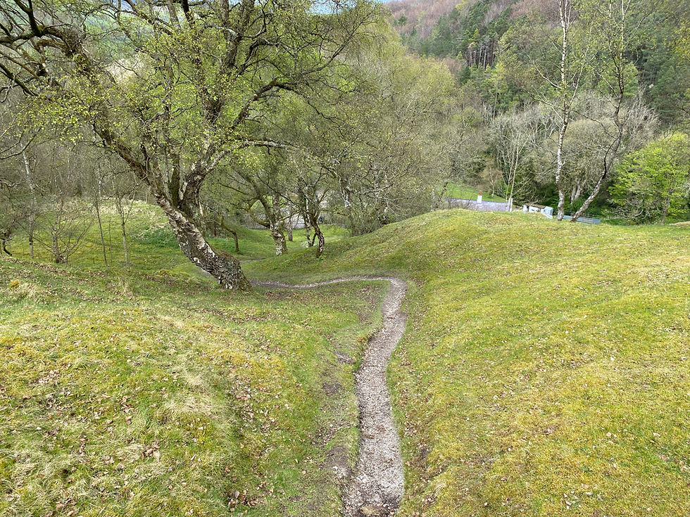
Rather than turn left toward the barn, turn right crossing a grassy patch of land toward a gate by the trees probably about 50 or 60m away (its not really that obvious - this photo should help). Exit the gate onto another rough track and follow it downhill toward the River Alyn. After crossing the river, the track turns uphill again for a short distance before meeting the main A494 directly opposite The Druid Inn and the promise of a well deserved beer. I thoroughly recommend the Purple Moose Elderflower Ale if they have it on tap. It is truly yummy.

As a footnote, I saw this butterfly in the hedge just as I crossed the river. Never seen one like this before - in flight it was white and orange on top of its wings. With wings folded on its flower of choice it was totally camouflaged. Turns out this an aptly named Orange Tip Butterfly. They are as common as starlings. Pretty though.


Comments