Bryn Cader Faner and Moel Ysgyfarnogod from Eisingrug
- daveatkinnerton
- Jun 11
- 7 min read
Updated: Jul 5
Walk: A fantastic walk through two eras of stone-obsessed history following part of the ancient route between the coast near Harlech and Llyn Trawsfynydd to reach the spectacular Ring Cairn of Bryn Faner Cader before taking in the atmospheric mine workings etched into the western side of Moel Ysgyfarnogod.
Distance: 7.5 miles
Bus Route: Not applicable on this one
Parking: At a small rough parking area (free) at the top of a single track road out of the evocatively named settlement of Eisingrug.
This is a P shaped walk, the head of the P being a (more-or-less) circular route taking in the remote and unusual Bryn Cader Faner - a ring cairn built like a crown of thorns high above the Afon Dwyryd Estuary (the one with Portmeirion on) - and the equally unusual 19th century mine workings cut into the rugged slopes of Moel Ysgyfarnogod above.

The walk starts at a small parking area at the top of a very steep single track lane from Eisingrug. Eisingrug is a very small settlement reached from the B4573 between Talsarnau and Harlech Village. The nearest name to the parking area on the OS map is Moel Glo but I'm not convinced your sat nav will know that. I referenced Hotel Maes Y Neuadd to get me on the right dead-end lane - and then just kept going past that until I ran out of tarmac. There is room for about four cars (optimistically) on either side of the lane. There is a ladder stile to the at the top end next to what used to be a gate to the drive to the remote property up here. If you are winging it without GPS, take the small lane signed to Eisingrug from the B4573 and look out for an even smaller small lane turning right, about half a mile further on, between a stone barn building and a telegraph pole with a street light on. It is marked with a dead-end sign. Once you have embarked on the single track lane, the parking place is just less than 1.5 tricky miles away.
You do a lot of breath-catching on this walk, the first one or two before you even get out of the car. I would advise against trying this if you have one of those big camper vans or anything - that would just be uber-stressful.
I did this walk with two friends and Rosie the swamp hound spaniel in May 2026. We ended up not making it to the top of Moel Ysgyfarnogod - tantalisingly just 500m distant when we timed out and turned tail. I'll do it again and add that last bit into this post some time later but it's too good a walk (even without the bragging rights of the peak) not to publish in advance of that.
It’s all too easy to use superlatives like epic, impressive, stunning and all that, but they do smell a bit like marketing. I'm selling nothing here,however, I have to say, the scenery and 'stonework' up here is way better than just very nice! You have to have gone to have seen, and you have to have seen to understand what I mean.

From the parking area, take the track with a gate at its head (with an angling club sign on) - to the right hand side of the lane as you were coming up. Follow this for just over half a mile (1km in new money), through three other gates, each having a ladder stile by the side. The second time I did this was following a night of heavy rain, the track was very much more muddy in patches - bypassable but waterproof boots were a big bonus.
The second and third gate come in quick succession. Just over 100m from the third gate, take a footpath (signalled by a marker post) angling off on the left heading North East just as the track turns due East toward the notable peak of Moel Ysgyfarnogod. The path climbs at first then levels out holding a contour above a wide marshier plateau to the right.

The track you are are on is part of an ancient byway from the estuary south of Harlech over to Trawsfynydd. After about a kilometre from where you left the track, you round a corner and get your first eyes-on to the profile of the target Bronze Age Ring Cairn on a slight hill in the distance. A definite intake of breath moment. It will, in all probability, have looked the same, and evoked the same response from the ‘bronzies’ who, approaching from this angle, also saw it for the first time when it was constructed 4000 odd years ago.

Bryn Cader Faner has had a bit of a tough paper-round, reportedly having been subject to 19th century tomb raiders and later ‘rearranged’ either before or after (or during) being used as target practice in WW2. It was subsequently reinstated to the ‘crown of thorns’ shape you see now. Whether or not this was the original imagining of the Bronze Age monument is I guess open to conjecture. It works very well though. It fits comfortably into its landscape (in a stand-out sort of way).
After having marvelled at just how epic Bryn Cader Faner is in real life, it’s time to move on toward a more modern age of stone, an age when the stone (manganese in this case) was discovered, dug out and hauled away from where it grew up due to its economic value. About as far away from spiritual as you can get.

The next target on the ‘P’ is a kidney-shaped lake called Llyn Dywarchen on the North West slopes of the highest peak in this area (Moel Ysgyfarnogod), under whose shadow Bryn Cader Faner stands. To get there, descend from the ring cairn to the depression worn by a small stream to the east. Cross the stream and climb steeply up the other side, heading to the left of a rock filled cut slightly to the right above. An indistinct path takes you clockwise around a small mound ( it could easily be the remains of mining spoil) to a position where it is easier to cross the rock filled cut and climb steeply and directly out on the other side. We couldn’t determine a particular path here but worked our way up diagonally left anyway.

Eventually you see the steep rock-face below the peak of Moel Ysgyfarnogod come fully into view, with the lake below it.
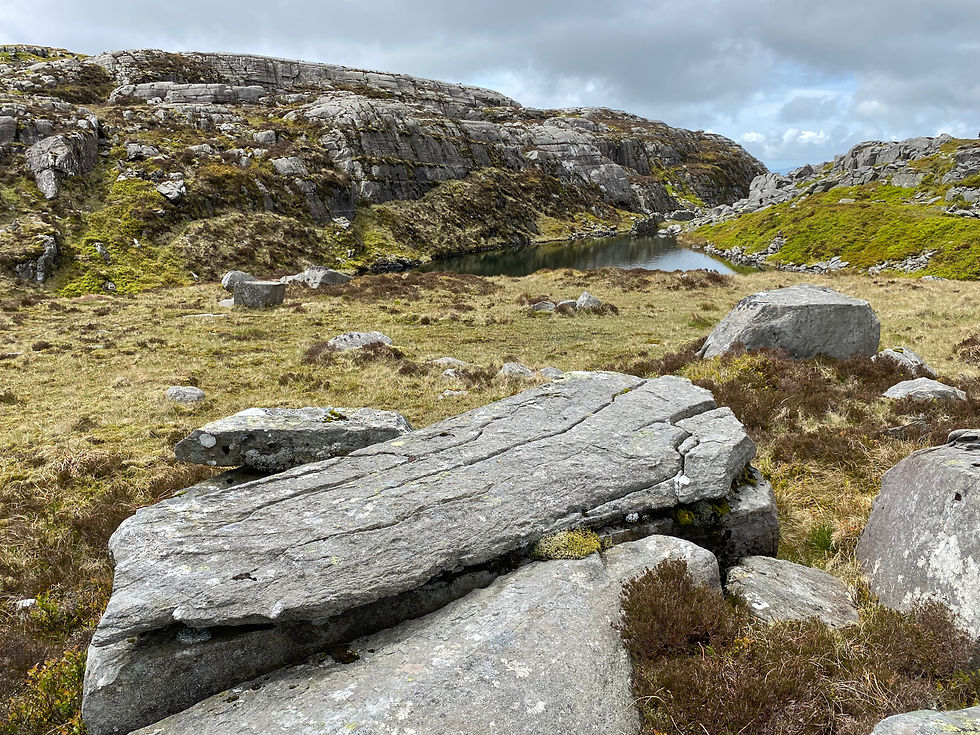
Keep to the right hand side of the lake until you see a man-made cleft between two dry-stone buttresses. Go through the cleft and continue down on a clearer path/track toward the smaller lake (the right-most one) below (Llyn Eiddew-Bach). After a short distance heading down, a track/path appears on the left hand side contouring around the rocky landscape to the south. Take this left turn.

This must have been one of the level tracks used to get the manganese from what must have been a seam close to the surface and parallel to the track you are on. There are multiple cuts in and a trench behind which gives the feeling of a collapsed burrow. It’s cool. But not as cool as what is in store as you follow the level around a jutting out rock to reveal the full extent of the mine workings that opens out to the south east.

Tolkien must have been here! It is very lord-of-the-rings-esque. Not hard at all to imagine being faced by a hoard of Orcs amid the echoes of metal on rock.
The level extends around Moel Ysgyfarnogod as far as you can see. Put the weird feeling of foreboding aside and follow it.
The track/path level eventually angles upward, just this side of a large stone wall.
Follow the path up alongside the stone wall until you arrive at a bwlch (pass) with a very still, clear and cold-looking small lake (that Gollum would have been quite happy to call home). This is Llyn Du (one of several with this name in the Rhinogydd) and you have now joined the Cambrian Way trail. Continue past the lake, climbing gently up through the boulder field. Some of these look like natural sarcophagi - adding to the atmosphere (Gollum's Grave maybe in any on-location sequel?). At this point you get your first glimpse into the valley beyond (with Llyn Trawsfynydd at its head) and eastern Eryri (Snowdonia) beyond that (see the photo of Rosie used as this post banner).

The Cambrian Way route tracks from North to South, taking in the peaks down the spine of the Rhinogydd range. Moel Ysgyfarnogod is the closest of these peaks to the north. The mountain’s unusual name has something to do with hares in English. Unsurprisingly, there were none to be seen. Maybe next time.
If you are going to do the peak from here, it’s a there-and-back-again, following the Cambrian Way contouring around from Llyn Du to the north then heading slightly down across a flat area before striking steeply uphill using the western shoulder of Ysgyfarnogod to make the summit (and back the same way). We, however, turned-tail where the above photo was taken and retraced our steps past Gollum’s lake and the land of Orcs and the collapsed-burrow mine workings until we were once again on the path above the smaller of the two lakes below (Llyn Eiddew-Bach).
Late addition: I returned and went up Moel Ysgyfarnogod in June 2026. It look literally less than 15 mins from where we turned back to reach the summit cairn and trig point. The route is as shown on the photo. Once on the shoulder the summit is very close.

Once above the lake, we turned left to continue the descent on a well defined path to the left-hand (south) side of the lake where the path becomes a track that snakes off into the distance back to where the car is parked. This is the other end of the same track that we were on right at the start of the walk. It’s quite a yomp along the track past the point we turned off to Bryn Cader Faner earlier, and eventually tipping out into the parking area - but, in dry weather, not at all unpleasant.
A final silent prayer that we wouldn’t meet any cars coming up the single track lane and we were off.
The car fuel consumption stats maxed out at 200mpg on the way back down! Then again it was probably in single digits on the way up.


Comments